
Gila Lower Box Recreation Area Management Plan and Environmental Assessment
Public Comment Period
Background and Introduction

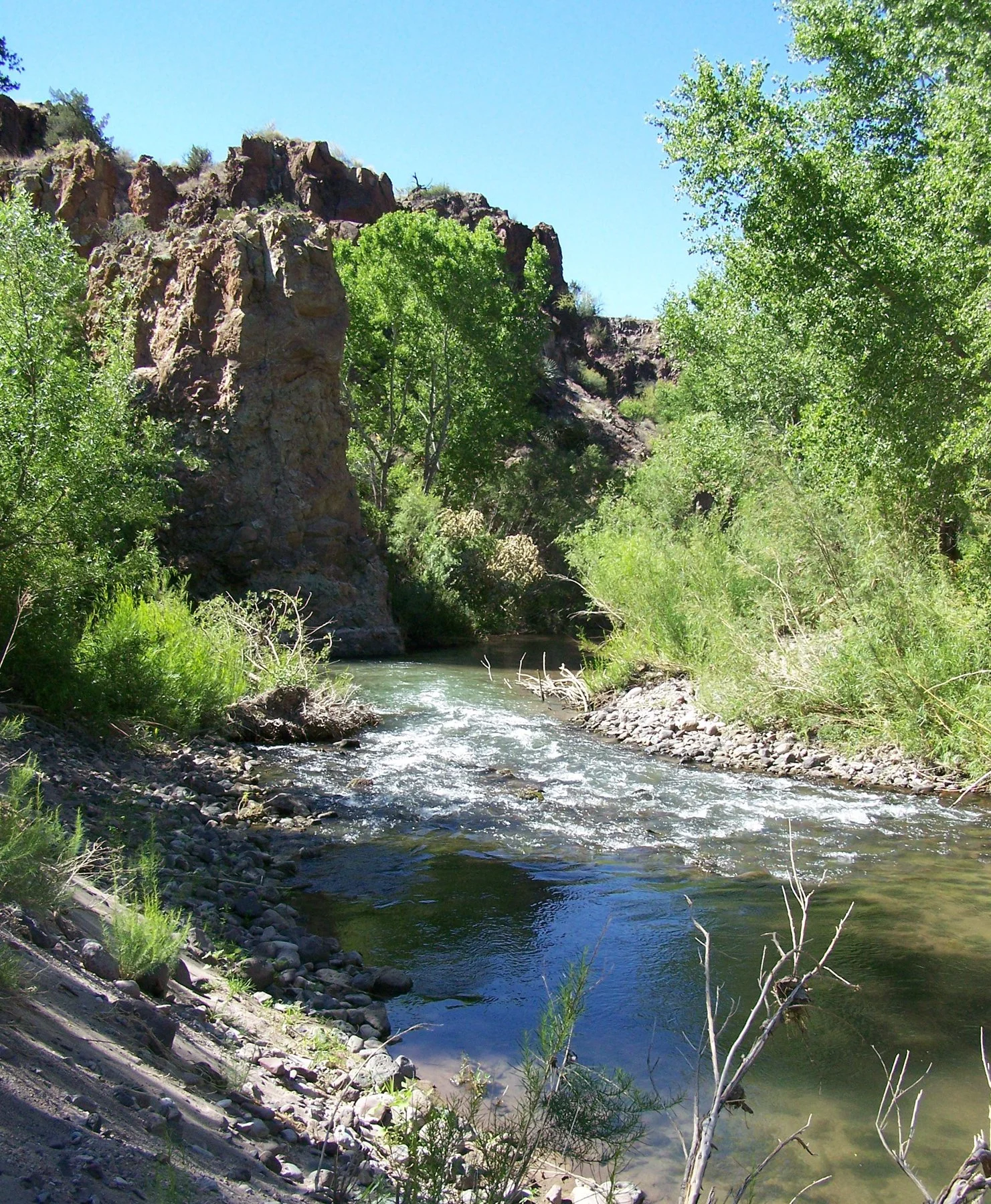
Gila Lower Box Canyon
The Bureau of Land Management Las Cruces District Office (BLM) is preparing the Gila Lower Box Recreation Area Management Plan (RAMP) along with an Environmental Assessment (EA) to evaluate proposed areas for the development of recreation resources. The EA analyzes the effects of these actions on wildlife habitat, rangeland health, soils, hydrology, and other resources.
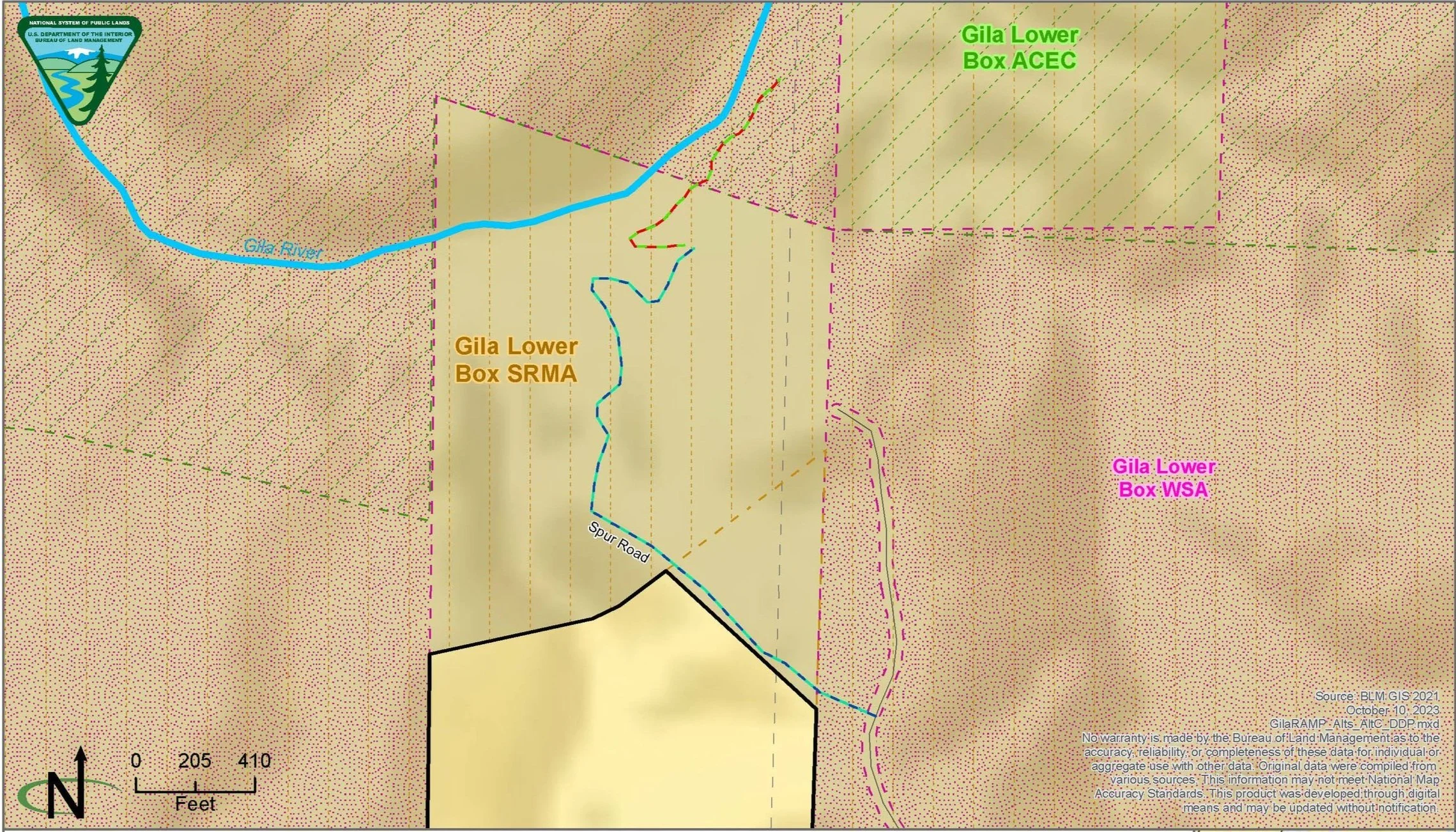
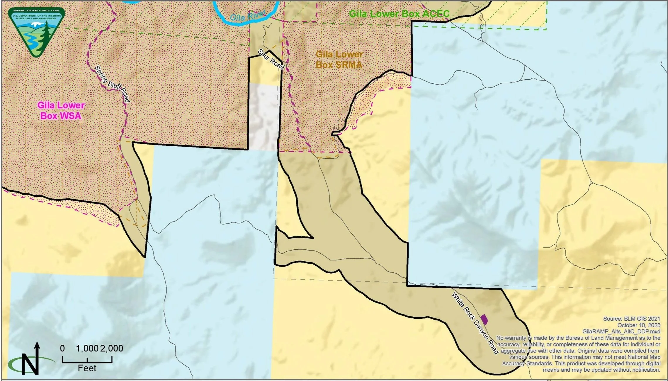
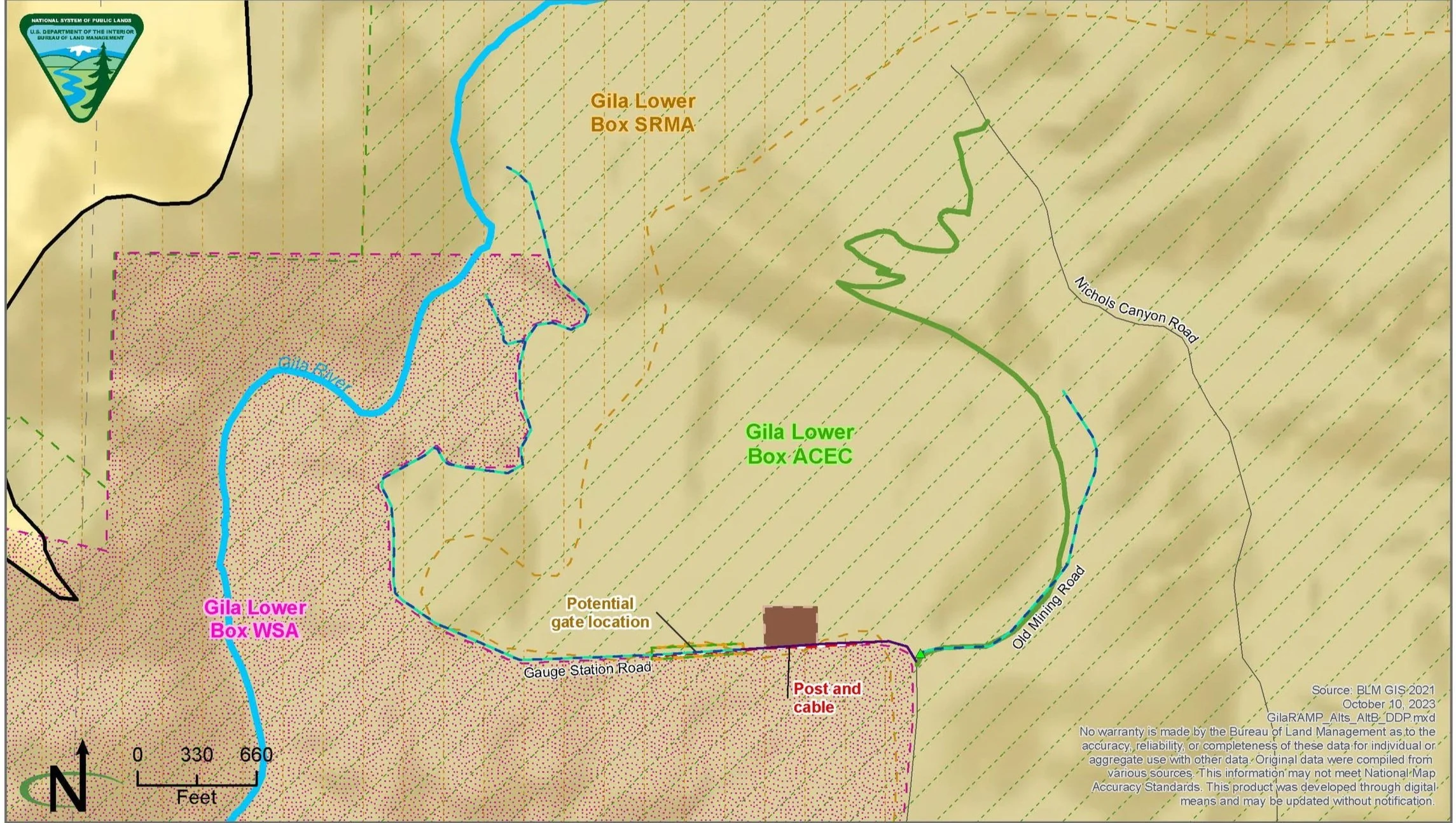
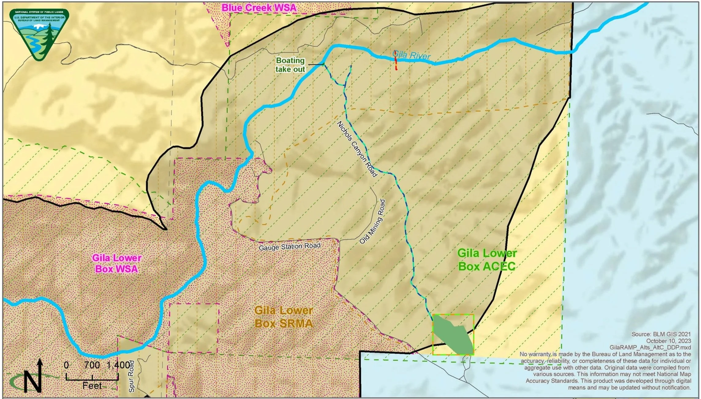
The Gila Lower Box is located approximately 20 miles northwest of Lordsburg, in Hidalgo County, New Mexico, and is a designated Wilderness Study Area (WSA), Area of Critical Environmental Concern (ACEC) and Special Recreation Management Area (SRMA).
The ACEC is around 6,490 acres. The site is characterized by cliffs and steep canyon sides rising above a significant riparian area with stands of Arizona sycamore, Fremont cottonwoods, willows, and associated vegetation. There are several State-listed and Federal candidate animal species that occur or have habitat within the area. The area also provides seasonal habitat for numerous species of raptors.
The BLM’s goal is to protect this sensitive area and provide a primitive recreation experience. The BLM is undergoing this planning effort to provide better access, interpretation, and recreation sites for the public as the Gila Lower Box grows in popularity and bring the area into conformance with the Mimbres Resource Management Plan. The RAMP is also considering all existing uses, agreements, and rights of stakeholders upstream and downstream of the Gila Lower Box while protecting sensitive plant, animal, wilderness, and cultural resources.
Gila Lower Box Canyon
NEPA and the Public Involvement Process
The BLM is preparing the EA associated with the RAMP because of the National Environmental Policy Act (NEPA). NEPA requires federal agencies to assess the environmental effects of their proposed actions prior to making decisions. In addition to describing the proposed action, providing information about resources within the analysis area, and analyzing the effect of the proposed action on those resources, an EA assists the decision maker. It assists the decision maker in selecting a course of action that would best meet the Purpose and Need for action, determining whether the proposed action is consistent with the Mimbres RMP, and determining whether an environmental impact statement is needed.
While not required during preparation of an EA, the BLM is choosing to engage the public as it develops the RAMP/EA. The initial opportunity for the public to comment was during scoping. The BLM used scoping to identify issues and concerns that stakeholders may have regarding the proposed plan and environmental analysis. The scoping process helped the BLM in the early identification of potentially affected resources and issues and potential alternatives to be considered in the EA.
The BLM is now requesting public comment on Chapter 1, Introduction, and Chapter 2, Alternatives, of the Draft EA. There will be a 30-day comment period for the public to review and comment on the alternatives and background information. This comment period will be held from November 1 to December 1, 2023.
There will be another opportunity for Public involvement later in the project when the BLM publishes the complete Draft EA.
EA Alternatives Maps
(Please click on map thumbnail, not the caption)
Fisherman’s Point
Spring on the Bluff
Gauge Dispersed Camping Area
Caprock Campground
Nichols Canyon
Nichols Canyon
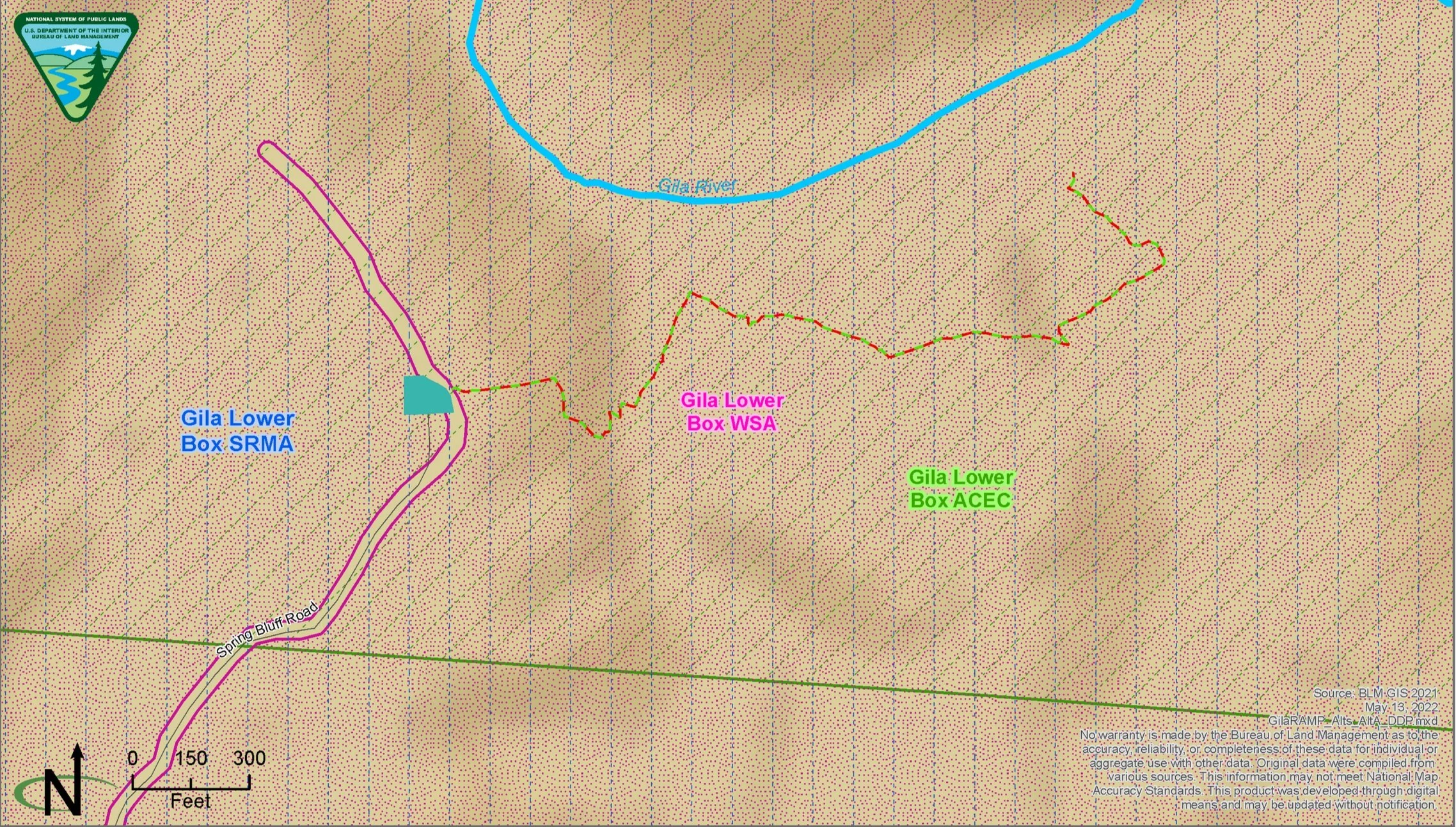
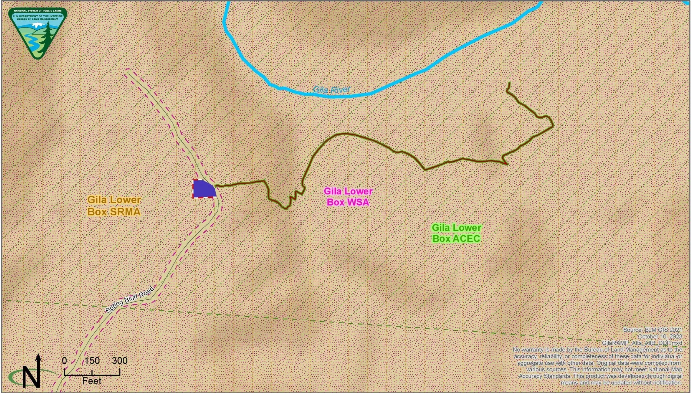


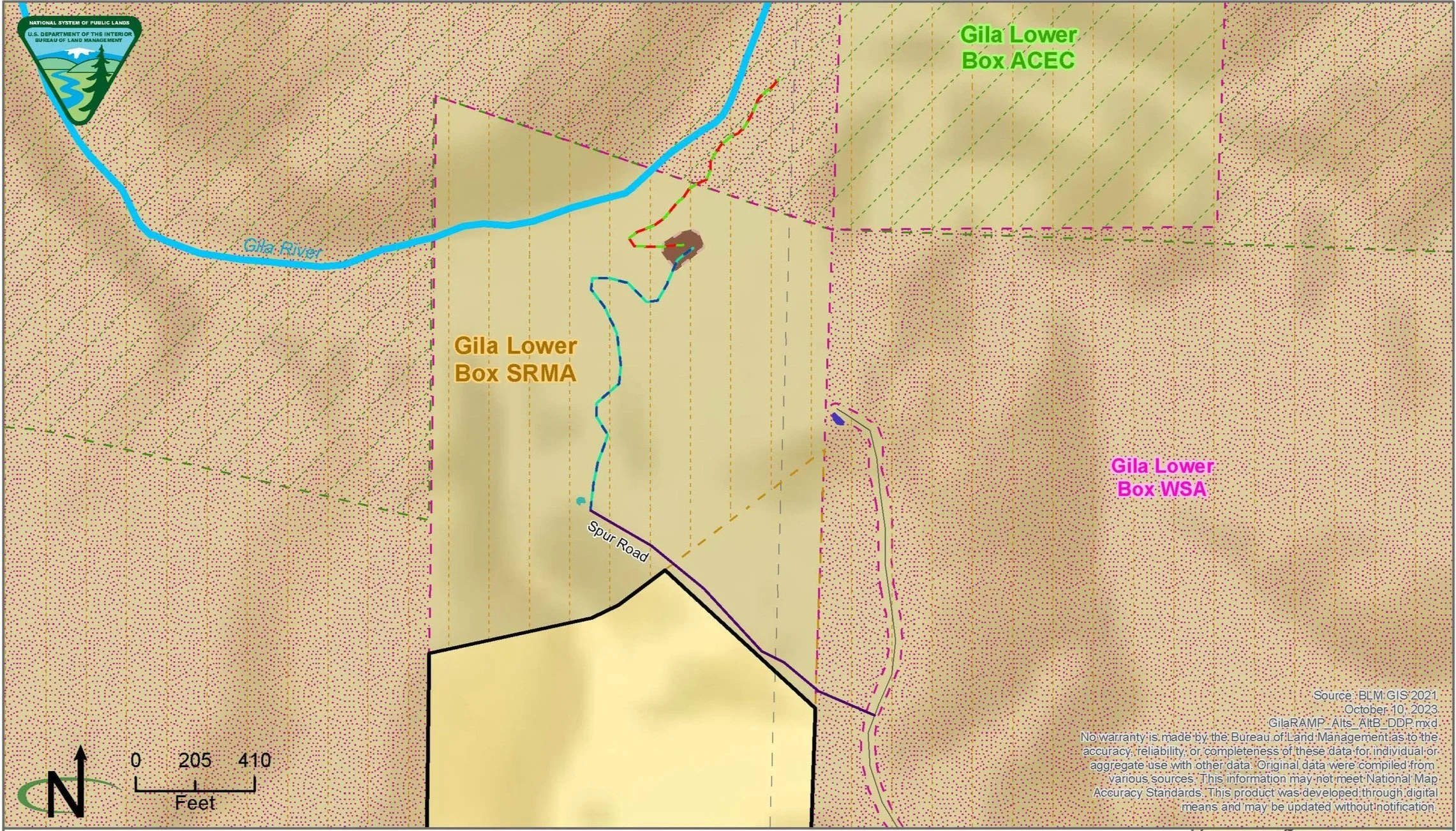


*Caprock Campground Preliminary Alternative A map not shown because no facilities would be constructed under this alternative.
Recreation in the Gila Lower Box
An interactive map below shows existing and proposed recreation facilities and management under each preliminary alternative in the Gila Lower Box SRMA (the planning area).
Preliminary Alternatives Overview Map
Notes on map use
You can access the map legend by toggling it on or off with the arrow in the upper left corner
Map layers can be turned on and off in the legend
You can click on a layer in the map to find out more information
Local residents can search for their address in the upper right corner
Public Scoping
The BLM conducted a 30-day scoping period from April 5 to May 5, 2022. During this time, stakeholders and members of the public had the opportunity to provide comments on the proposed action. The public also had the opportunity to attend a virtual public scoping meeting on Tuesday, April 26, 2022. The meeting recording and transcript can be accessed by clicking the links below.
The public had the opportunity to submit scoping comments via BLM’s ePlanning website, mail, and verbally during the virtual public scoping meeting. BLM will review all comments submitted and use them to help inform the alternative development process.

Cactus in Gateway Canyon
For more information, visit BLM’s ePlanning website.
If you have further questions, you may contact BLM Outdoor Recreation Planner Allie Bettinger, at abettinger@blm.gov or at (575) 525-4414.